By Charlton Ziervogel (on behalf of CORC)
Urbanization and the growth of informal settlements
Urbanization in South Africa has not followed the usual patterns as witnessed in many other developing countries from the 1980’s through to present day. This was in large part due to government interventions in the process up to the 1990’s, which saw to a very controlled restriction of movement of people from rural to urban centres (Turok, 2012) that effectively slowed the process. With the fall of the Apartheid government and the abolishment of the laws of controlled movement into urban areas the post 1994 period in South Africa saw massive increases in urbanization. Looking at the period 1980, in which 42,5% of the population lived in urban areas (Giraut & Vacchiani-Marcuzzo, 2005), in which 60% of the population lived in urban areas (United Nations, 2011), we witness a jump in the urban population of 17,5%.
It is no coincidence that during the period 1994 to 2011 informal settlements in South Africa increased in number from approximately 300 [1] to around 2700 in 2011 (SACN, 2011) due to the inability of government to keep up with housing demand. This growth in informality has been focused in urban areas with Western Cape municipalities experiencing influx due to a number of factors, including better employment opportunities, access to services and perceived increases in quality of life. This growth has resulted in shacks in backyards and shacks not in backyards accommodating almost 20% of all households in the province (HDA Western Cape, 2013).

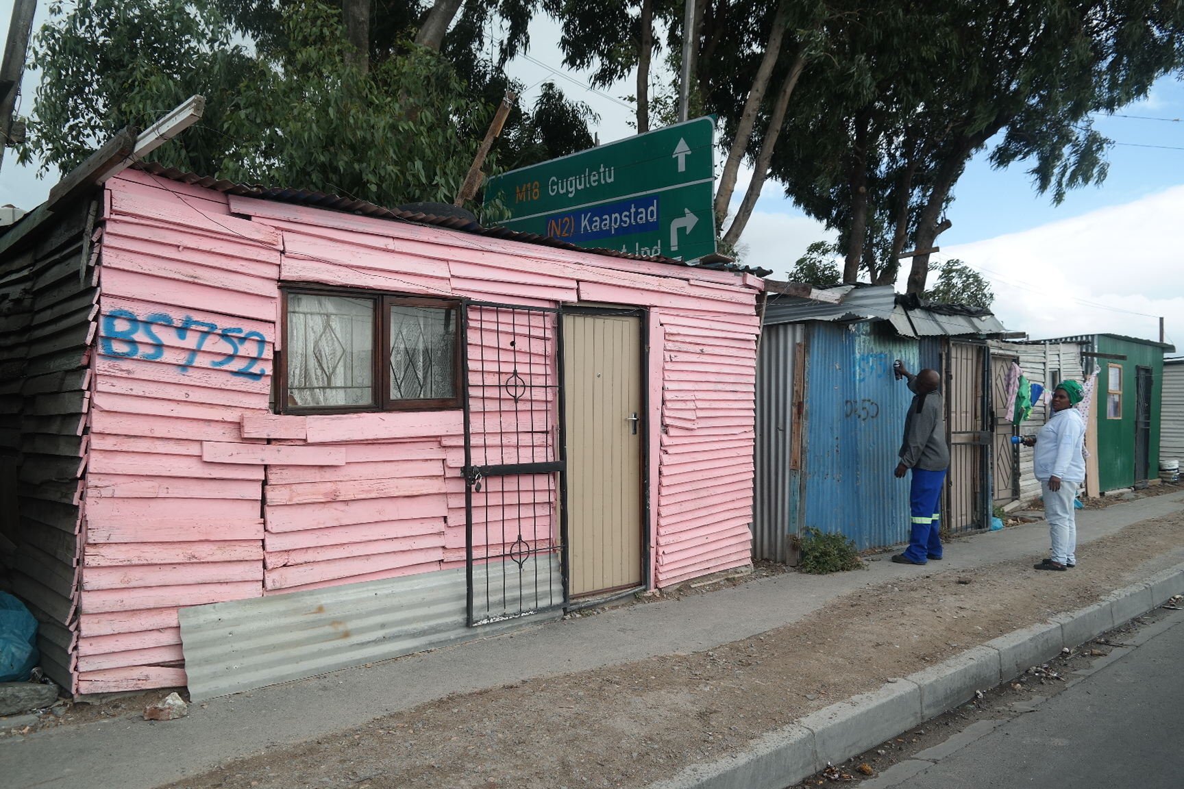
Khayelitsha
What we lack in current data on informal settlements
Engaging with the Western Cape Province, and the City of Cape Town in particular, the scale of informality as described by 2011 census statistics is thus apparent (almost 1 in every 5 households live in informal structures). Yet, this information is already 4 years old and the continued rapid influx of people and changing spatial configurations and distribution of informal settlements over relatively short periods of time, places the province and the City of Cape Town in the very vulnerable position of trying to address problems of informality with information that is no longer reliable and in need of updating.
To effectively implement any successful upgrading plan or strategy as posited in National Upgrade Support Programme (NUSP) and the Upgrading of Informal Settlements Programme (UISP), municipalities need far more nuanced information to inform upgrading strategies. Census data is not aggregated at settlement level (HDA RSA, 2013) further compounding the ability to take into account settlement specific needs and context. The National Development Plan (NDP) also emphasizes the general lack of adequate information about the nature and conditions of each of the informal settlements, further hampering the strategic use of resources or the development of settlement specific solutions (NDP, 2012).
The value of community data and how it is collected
It is within this data deficiency, that community led housing enumeration and GIS mapping projects need to be positioned to better equip municipalities and provinces with updated information on informal settlements, placing actors in municipalities and provinces in a position to adequately plan for future upgrading developments in these settlements.
Amongst the methodologies employed for information gathering is the tool of informal settlement enumerations and the detailed mapping of settlements using GIS technology.
Shack numbering in Nyanga

Mapping shack numbers in Nyanga
These tools derive their origins from the Shack/Slum Dwellers International (SDI) network, where for more than 30 years the SDI network recognized the importance of accurate and reliable data on informal settlements to help urban poor communities engage their local authorities in building effective partnerships towards a city-wide approach to in-situ informal settlement upgrading strategies (Arputham, 2012). The key difference in the SDI approach is that critical focus is placed on a community driven process, which allows for greater scale of activities and interventions as well as higher success rates in terms of the implementation of upgrading projects.

Profiling in UT Gardens, Khayelitsha
Within the context of informal settlement enumerations and mapping, this participatory approach is even more valuable as it has proven time and time again in various developing countries that when a mobilized community understands the importance of accurate data and maps and participates in the collection of this data around their own settlement, far higher degrees of accuracy are achieved than any census or survey that might utilize “outsiders” as the sole enumerators (Baptist & Bolnick, 2012, Livengood & Kunte, 2012).
Community Based Data Collection in Cape Town: Joe Slovo, Mtshini Wam, Kuku Town, and Flamingo Crescent
As urban poor people’s networks, FEDUP and ISN, together with CORC, have gathered experience in gearing communities towards self-enumeration and mapping.
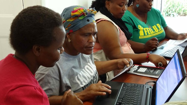
Community members capture enumeration data
For example, information available to the City of Cape Town had estimated the population of Joe Slovo along the N2 (N2 Gateway project) to be way larger than reality with the proposal of only a percentage of the residents being part of the housing project causing real concerns amongst the community. An enumeration conducted in 2009 spearheaded by the SA SDI Alliance was able to ascertain a more accurate population size based on a participatory approach, which paved the way for the possibility of the housing development moving ahead with all the current residents at the time included.
Other examples in Cape Town include the re-blocking of Mtshini Wam, Kuku Town and Flamingo Crescent informal settlements which all utilized the community driven enumeration and mapping approach to set up accurate beneficiary lists. These enumeration and GIS databases developed by CORC, ISN and FEDUP have been utilized by the City of Cape Town in the provision of electricity connections, contract work through the Expanded Public Works Program (EPWP) as well as assisting in detailed layout plans for the re-configuration of the settlements.
The necessity of working relationships with government
All this is only achievable through the establishment of practical working relationships and partnerships with government. In addressing the data deficiency described above this approach is not merely to gather information but to create the added benefit of a very practical community and local authority partnership.
Participatory data collection is an approach built upon the successes and lessons learnt in over 2 decades of informal settlement enumerations by the SA SDI Alliance. The Alliance’s experience in the implementation of 144 informal settlement enumerations in South Africa over the past 6 years, covering approximately 65,400 households has shown that the approach of deep community participation, even at the level of the data gathering exercise, leads to stronger community networks with the ability to assist local governments in prioritizing upgrading initiatives within a broader strategic framework. Furthermore, this deep participatory approach mobilizes communities towards determining their own development agendas.

Community generated data informs community planning
References
- Arputham, 2012. How community-based enumerations started and developed in India, Environment and Urbanization 2012 24:27, Sage, IIED
- Baptist, C and Bolnick, B. 2012. Participatory enumerations, in situ upgrading and mega events: The 2009 survey in Joe Slovo, Cape Town, Environment and Urbanization 2012 24:59, Sage, IIED
- Giraut, F. and Vacchiani-Marcuzzo, C. 2009. Territories and Urbanisation in South Africa: Atlas and geo-historical information system. Institut de Recherche Pour le Developpement, Paris.
- Housing Development Agency (HDA), Western Cape: Informal Settlements Status 2013. Research Report, HDA
- Housing Development Agency (HDA), South Africa: Informal Settlements Status 2013. Research Report, HDA
- Livengood, A and Kunte, K. 2012. Enabling participatory planning with GIS: a case study of settlement mapping in Cuttack, India, Environment and Urbanization 2012 24:77, Sage, IIED
- SACN (South African Cities Network) 2011. 2011 State of SA Cities Report. SACN, Johannesburg.
- South African Government Information. 2012. Our Future – make it work: National Development Plan 2030. 14 November 2012. http://www.gov.za/documents/national-development-plan-vision-2030
- Turok 2012. Urbanisation and Development in South Africa: Economic Imperatives, Spatial Distortions and Strategic Responses. Urbanization and Emerging Population Issues Working Paper 8, International Institute for Environment and Development United Nations Population Fund
- United Nations, Department of Economic and Social Affairs, Population Division. 2012. World
- Urbanization Prospects: The 2011 Revision
[1] Presentation made by NUSP at the Policy Consultative Workshop held on 5 September 2014 at the Town House Hotel (Cape Town)
That is good W/Cape keep it up. Peter Goodman from the Eastern Cape Amandla