By Barbara Torresi, CORC
The importance of spatial mapping
Settlement profiling was originally designed to complement the enumeration process and has hitherto consisted of a narrative description of the state of the infrastructure in any given informal settlement. This text-heavy approach, however, has done little to improve our knowledge of the spatial distribution of the settlement’s facilities, rendering the process an interesting but scarcely workable exercise. Yet, the potential applications of spatial analysis are huge, for strategic mapping goes beyond a simple reading of a settlement’s physical layout by deconstructing and decoding its deeper structure. This can thus uncover shortcomings in both the physical and socio-economic environment on one hand, and ways to respond to them on the other. For example, a municipality’s ability to intervene swiftly in the event of an accident is dependent on the emergency team’s knowledge of the space they are being called into. Similarly, a feeding scheme for low-income families can benefit greatly from knowing exactly where the neediest households are located. But above all, a clear understanding of a settlement’s strengths and weaknesses can help communities prepare convincing development plans to be submitted for governmental approval.
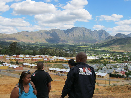
Spatial mapping in Langrug, Franschhoek
It was with these thoughts in mind that in March 2011 Langrug’s leadership created a dedicated profiling team to work side by side with its enumerators. The aim of the project was to map the settlement’s existing infrastructure by identifying on a scaled aerial photograph the location and conditions of all toilets, water taps, drains, drainage gullies, electricity boxes, and street lights. Moreover, Langrug’s open spaces, circulation patterns, and commercial services were also plotted on the map, throwing new light on the relationship between the settlement’s physical and social environment. For example, by superimposing the commercial activity layer to the map depicting the state of Langrug’s ablution facilities it became evident that toilets within a certain radius of shebeens are the worse for wear. While this might be pointing out the obvious, visualising causality on a scaled map can help engineers tackle specific problems by providing tailor-made solutions to them, such as – in this case – more resistant, ‘anti-thug’ facilities next to drinking venues and high transit areas. On March 30th 2011, the profiling team presented the results of its efforts to the Stellenbosch municipality’s board of directors, which received the presentation enthusiastically and requested a community masterplan to be submitted to them before the next budget allocation meeting in June 2011.
Technology in Mfuleni, Cape Town
Meanwhile, another dedicated spatial profiling team in Los Angeles, a small informal settlement on the edges of the Cape Town township of Mfuleni, was developing its own mapping strategy by flirting with technology. Here digitalisation was achieved by using GIS software to trace the outlines of all the built-up structures in the study area and then incorporating information from the enumeration into the database to aid thematic analysis. The resulting maps, together with a non-community driven study in another Cape Town slum named Europe, were presented to a delegation headed by the deputy minister of science and technology, Derek Hanekom, on May 4th 2011. His positive response to these maps, which illustrated the analytical sophistication that GIS can contribute to profiling by allowing the spatial representation of cross-referenced socio-economic indicators, will hopefully pave the way for a mutually beneficial cooperation between government and grassroot movements.
Moving forward
What was still lacking, however, was an upgrading proposal to translate the wishes of disadvantaged communities into workable – and budgeteable – interventions that can provide more than a quick fix to some contingent infrastructure-related problem. This spurred CORC’s move into the next phase of its smart planning roadmap, a two-pronged strategy that aims to increase mapping efficiency whilst accelerating the planning process itself. Therefore, CORC is now enhancing the analytical phase of its current profiling strategy by introducing GIS-based mapping across the region’s informal settlements. This will be achieved by seeking collaborative partnerships with government and academia without, however, losing sight of the community-driven nature of the process. At the same time, existing settlement profiles, whether hand-drawn or computer-aided, will be analysed fortwith with the aim of creating developmental, energy conscious, and upgradeable masterplans that are able to respond to the needs, present and future, of the country’s most disadvantaged communities.